
Features AgroforMap
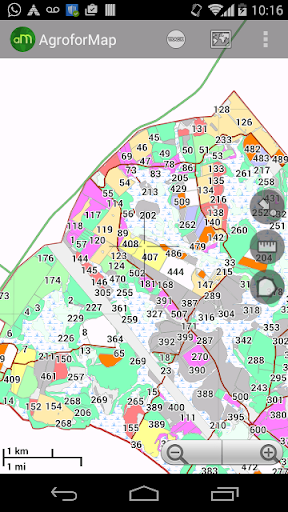
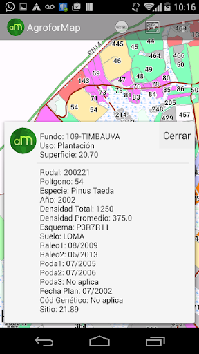
Application Features:- The data for each field of each planting within reach of a click on the screen;- Quick consultations on the situation of each plantation: performance, applications, management executed, previous crop, so planting, planting date, soil, etc.
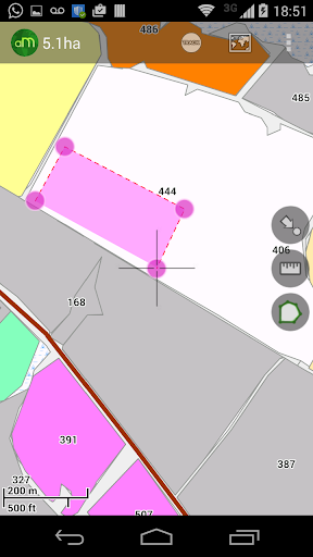
(The variables are unique to each client);- Function for calculating areas and measures distances;- Function "My position" that allows the user to accompany the device location;- Photos, screenshots, multi schemes maps, recording routes;- Easy and quick handling of the application allows the user to practical experience;- Enables offline access to all the maps and database clients;- Without the need for field maps and spreadsheets, application activities and optimizes operator time;- Your company with much greater speed and agility in agroforestry.
Camera Features
Advanced camera features with editing capabilities.
Food & Dining
Discover recipes and order food from your favorite restaurants.
Smart Home
Control and monitor your home with smart features.
See the AgroforMap in Action
Get the App Today
Available for Android 8.0 and above